Professional Land Surveying
Contact A Specific Surveyor
Control
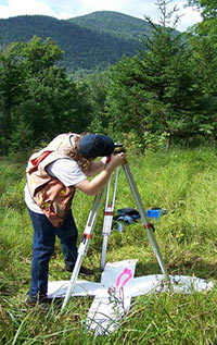 Plisga & Day sets control points or baselines for a wide variety of projects. The control monuments may be simple nails for short turnaround building, road and construction projects or more permanent buried concrete or stone for city wide control, landfill monitoring or dam deformation studies. The control information can be coordinated and shared with contractors for their own work with aerial photography, LIDAR flights, construction layout or machine control.
Capabilities:
- Photogrammetric
- Machine Control File and Base Point Coordination
- LIDAR Base Station and Ground Truthing
- Horizontal & Vertical Networks
- State Plane Coordinate Determination
- GIS / LIS Data Collection
- Ground Truthing for Remote Sensing
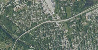
- Typical GPS Vectors for a Photo Control Network
The following are some typical control projects Plisga & Day has performed:
- The City of Waterville, Maine hired Plisga & Day to set permanent control monuments and semi-permanent monuments throughout the City for all future projects to tie into. Northing, Easting and Elevation were published for all monuments.
- Permanent control for aerial photographs was set around pulp wood piles at Champion International Paper in Bucksport, Maine. These permanent targets were set on steel posts in cement and painted white for visibility on all future flights.
- Permanent control for aerial photographs was set at Pine Tree Landfill Facility in Hampden, Maine for monitoring the landfill volume.
- Latitude and longitude was calculated for several control points set at the United States Coast Guard Station in South Portland, Maine.
- Ground truthing for aerial photographs around gravel pits to assist photogrammetrists in computing volume estimates.