Professional Land Surveying
Contact A Specific Surveyor
Cartography
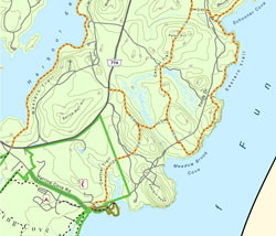 Plisga & Day’s extensive use of mapping tools making maps for site mapping and boundary purposes extends into the creative developing custom creations such as recreational trail maps, conservation trust exhibits, land cards, access maps, depth maps and color coded buried utility maps.
Our use of CAD and Geographic Information Systems allows for complex datasets to be rendered into stylish and more importantly useful every day maps. Topography can be used to generate shaded relief maps highlighting rises or depressions of the terrain. Digital images can be added to augment signs or symbols on a map.