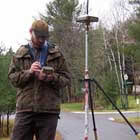
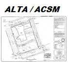
Residential & Commercial Boundary Surveying
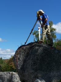 Plisga & Day offers a variety of boundary related services such as title research, field investigation, road review, corner monumenting, or line marking. These services are combined to furnish a product requested by the client. Boundary Surveys are performed on the smallest of camp lots to large tracts of land. ALTA/ACSM Land Title Surveys are a nationally standardized boundary survey and are often requested for commercial properties. Mortgage Inspection Sketches are an instrumental step in obtaining most bank loans. While not a full boundary survey, these inspections serve a specific purpose. In some situations, research may be all that is needed. We also prepare custom Title Sketches or Surveyors Certificates and often work with other professionals, such as attorneys, to solve questionable parcels.
Development
 Plisga & Day provides many types of land development, engineering or architectural related measuring and project management services. We regularly work on a team that may include an environmental consultant, engineer or architect who work together to submit your proposal to a municipality for project review. Depending on the project, we are often the lead consultant that prepare forms, plans and communications to the review authority.
Read More…
Municipal
 Plisga & Day works with many towns and cities to accommodate the needs of today’s growing communities.
Read More…
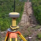
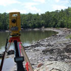
Control
 Plisga & Day sets control points or baselines for a wide variety of projects. The control monuments may be simple nails for short turnaround building, road and construction projects or more permanent buried concrete or stone for city wide control, landfill monitoring or dam deformation studies. The control information can be coordinated and shared with contractors for their own work with aerial photography, LIDAR flights, construction layout or machine control.
Read More…
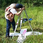
Specialty Services
 Plisga & Day enjoys the challenge of unique surveying applications by adapting or creating measuring techniques and technologies.
Read More…
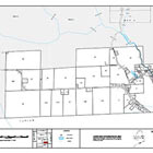
Cartography
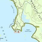 Plisga & Day’s extensive use of mapping tools making maps for site mapping and boundary purposes extends into the creative developing custom creations such as recreational trail maps, conservation trust exhibits, land cards, access maps, depth maps and color coded buried utility maps.
Read More…
Flood Elevation and Letter of Map Amendment
 Plisga & Day have assisted hundreds of clients with property on or adjacent to the Maine Coast, inland lakes, rivers and streams. Are you in the flood zone?
Read More…
Title Insurance Support
 We also work to support attorneys with Title Insurance review or claims. Our surveyors review title reports, provide additional research in town and county records and upon request will search for private records.
Read More…
Expert Witness & Litigation Support
 Over time our experienced surveyors have been called to support clients as an expert witness in arbitration, depositions and court testimony.
Read More…